
Alaska Hydrologic Survey
Objective
The objective of the Alaska Hydrologic Survey (AHS) is to provide technical hydrologic information to ensure proper and accurate management of the State's water resources for the benefit of the people of the State of Alaska. Hydrologic data are provided to state, federal, and municipal governments, as well as industry and the general public.
Surface Water
Stream Discharge Measurement
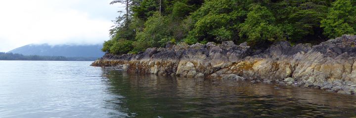
Alaska has the greatest surface water resources of any state in the United States. Approximately 40% of the all the surface water outflow for the entire U.S. comes from Alaska. The state receives an average of approximately 1,050,000 million gallons per day (Mgal/d) in the form of precipitation. The Yukon, Kuskokwim, and Copper Rivers are among the ten largest rivers in the U.S., and the state has over 3 million lakes. The Alaska Hydrologic Survey collects, analyzes, and interprets surface water data for the citizenry of Alaska.
Alaska Surface Water Facts
- Many of Alaska's lakes and streams are frozen, or partially frozen, for five-six months of the year. In late April and May, "breakup" occurs when the snow melts, and the lakes and streams thaw.
- A typical Alaska stream experiences low flows from December through March, peak flows during breakup in May-June, lower summer flows in July and August, secondary peak flows produced by rainfall in September-October, and declining flows in November.
- Glaciers significantly influence most of Alaska's major rivers, even though glaciers cover just 5% of the state. For example, glaciers cover only 5% of the Tanana River drainage basin, yet glacial meltwater accounts for half of the river's runoff.
- Surface water supplies approximately 75%, or about 300 Mgal/d, of the state's water needs for industry, agriculture, mining, fish processing, and public water use.
- Surface water is used for about half of Alaska's domestic water supply.
- Hydroelectric powerplants use approximately 1,400 Mgal/d of surface water to generate 20% of the state's electricity.
- Even with all of the surface water in Alaska, a number of communities experience water quantity problems because of inadequate supplies (especially in permafrost regions), lack of satisfactory distribution systems, and droughts.
- Flooding and erosion are responsible for millions of dollars of property damage each year. Most of the flooding that occurs in Alaska results from:
- Rainfall
- Snowmelt
- Ice jams clogging stream channels, backing up flow, causing upstream flooding
- Glacial outburst floods: nearly 750 glacier-dammed lakes have been identified in Alaska; if the glacial ice dam fails, lake water is released resulting in downstream flooding.
- Flooding can also be caused by the rapid melting of snow and ice during volcanic eruptions.
- Alaska's surface waters include over 15,000 anadromous streams (that is, they support runs of spawning seagoing fish, including salmon).
- Surface water instream flow can be appropriated to support fish and wildlife habitat.
The Division of Mining, Land and Water, Water Management Section, oversees the management and appropriation of Alaska's surface water.
Groundwater
Alaska has the greatest groundwater resources of any state in the United States. Groundwater resources are used for most domestic needs around the state.
Groundwater supply aquifers range from extremely small thaw bulbs in permafrost to large regional aquifers. The extensive permafrost development around the state provides challenges to the development of groundwater resources.
In many parts of Alaska, steep topography limits the size of most aquifers, preventing large scale extraction. Groundwater is also used for bottled water export and many industrial operations, such as mining. Warm groundwater discharging to the Chilkat River allows the river to stay unfrozen in the early winter. This has allowed a late run of salmon to become established and over 3,000 bald eagles gather in the early winter to feed on the fish.
Alaska Groundwater Facts
- Alaska has the largest volume of frozen groundwater in the U.S.
- In the spring, much of the groundwater recharge comes from snow melt.
- Groundwater generally discharges to lakes and streams, but may discharge into the oceans.
- Some groundwater is removed, via wells, using pumps.
- In the winter, Alaska groundwater from springs and seeps freezes, forming icing or "aufeis".
The Division of Mining, Land and Water, Water Management Section, oversees the management and appropriation of Alaska's groundwater.
Water Quality Sampling
Most of Alaska's waters are suitable for the following beneficial uses:
- water supply (drinking, agriculture, aquaculture, industrial);
- water recreation;
- growth and propagation of fish, shellfish, aquatic life, and wildlife.
Some beneficial uses are limited by natural water quality conditions in Alaska:
- suspended sediment in glacial waterbodies;
- highly mineralized waterbodies;
- microorganisms such as giardia (beaver fever), schistosoma (swimmer's itch);
- and high bacterial counts from decomposing salmon in streams.
Beneficial uses can also be limited or impaired by the following human activities in Alaska:
- Natural resource development: oil & gas development, transportation, mining, timber harvesting, and seafood processing;
- Urban development: urban runoff, septic systems, and landfill leachate;
- Military development: abandoned installations and operational installations.
Urban runoff is the most common pollutant source in Alaska. Fecal coliform bacteria, sediment, and petroleum products are the primary pollutants of surface waters in Alaska. Petroleum products are the primary pollutants of ground waters in Alaska.
Meteorology
The Alaska Hydrologic Survey performs meteorological studies, often as components of larger hydrologic investigations or projects. Precipitation (either as rain or snow), temperature, and low level, local winds are the principal elements that we study. A project usually includes on-site measurement and long-term sensing and recording, followed by data analysis and interpretation.
Projects
Current Projects
- Hydrologic support for Alaska's Surface Coal Mining Program
- Hydrologic support for Large Mine Permitting and Compliance
- Alyeska Ski Resort Stream Gaging
- Tuluksak Stream Gaging
- Unalaska Stream Gaging
- Interior Alaska Stream Gaging and Sediment Sampling
- Database Management and Maintenance
- Support for the Water Management Section (including hydrologic analysis)
Past Projects
- Old Harbor Stream Gaging (DCRA, Div of Energy/AK Village Elec. Coop)
- Kenai River Mgmt Plan, Wetlands Work Group
- Water quality assessment of Ship Creek, Anchorage, AK
- Matanuska River drainage basin study
- Hydrologic assistance on Indian fuel spill (DEC Contaminated Sites Program)
- Old Hiland Dump ground-water investigation
- Nonpoint pollution impacts from agriculture in Alaska's coastal zone
- Water supply investigation at Chefornak, AK (Village Safe Water Program)
- Groundwater investigation at Sterling, AK
- Water resources assessment for proposed Shepard Point road, near Cordova, AK
- Groundwater assessment at Alaska Railroad yard at Fairbanks, AK (USGS coop project)
- Groundwater investigation at Nikiski, AK
- Surface water resources of Glacier Creek watershed, Girdwood, AK
- Water supply investigation at St. Paul, AK (Village Safe Water Program)
- Water resources assessment for proposed Copper River highway
- Recharge area delineation for Moonlight Springs near Nome, AK
- Aquifer mapping at Anchor Point, AK
Statutes and Regulations
The statutory basis for the Alaska Hydrologic Survey (AHS) existence and programs are under AS 41.08. Under those guidelines, AHS is specifically charged with "the systematic collection, recording, evaluation, and distribution of data on the quantity, location, and quality of water of the state in the ground, on the surface of the ground, or along the coasts, are in the public interest and necessary to the orderly domestic industrial development of the state."
Sec. 41.08.010. Division of geological and geophysical surveys. There is established in the department a division of geological and geophysical surveys under the direction of the state geologist. ( 1 ch 93 SLA 1972)
Sec. 41.08.015. State geologist. The commissioner shall appoint the state geologist, who must he qualified by education and experience to direct the activities of the division. ( 1 ch 93 SLA 1972)
Sec. 41.08.017. Hydrological and seismic hazard data declared to be of public interest.
(a) Systematic collection, recording, evaluation, and distribution of data on the quantity, location, and quality of water of the state in the ground, on the surface of the ground, or along the coasts, are in the public interest and necessary to the orderly domestic and industrial development of the state
(b) Systematic collection, evaluation, archival, and distribution of geologic data and information on earthquakes, volcanic eruptions, and engineering geology and identification of potential seismic, volcanic and other geological hazards throughout the state are in the public interest and necessary to orderly, safely, and cost-effective development in the state ( 1 ch 41 SLA 1977; am 1 ch 101 SLA 1983; am 3 ch 36 SLA 1987)
Sec. 41.08.020. Powers and duties.
(a) The state geologist shall conduct geological and geophysical surveys to determine the potential of Alaskan land for production of metals, minerals, fuels, and geothermal resources; the locations and supplies of groundwater and construction materials; the potential geologic, hazards to buildings, roads, bridges, and other installations and structures; and shall conduct such other surveys and investigations as will advance knowledge of the geology of the state. With the approval of the commissioner, the state geologist may acquire, by gift or purchase, geological and geophysical reports, surveys, and similar information
(b) In addition, the division of geological and geophysical surveys shall:
- (1) collect, record, evaluate, and distribute data on the quantity, quality, and location of underground, surface, and coastal water of the state;
- (2) publish or have published data on the water of the state;
- (3) require the filing with it of the results and findings of surveys of water quality, quantity, and location;
- (4) require of water well contractors, the filing with it of basic water and aquifer data normally obtained, including but not limited to well location, estimated elevation, well driller's logs, pumping tests and flow measurements, and water quality determinations;
- (5) accept and spend funds for the purposes of this section, AS 41.08.017, and 41.08.035 and enter into agreements with individuals, public or private agencies, communities, private industry, state agencies, and agencies of the federal government;
- (6) collect, evaluate, and distribute geologic data on seismic events and engineering geology of the state;
- (7) identify potential seismic hazards that might-affect development in the state;
- (8) inform public officials and industry about potential seismic hazards that might affect development in the state. ( 1 ch 93 SLA 1972; am 2 ch 41SLA1977; am 7 ch 175 SLA 1980; am 2 ch 101 SLA 1983; am 4 ch 36 SLA 1987)
Cross references.-For declaration of sources, see 1, ch. 175, SLA 1980, in the legislative policy on geothermal re- Temporary and Special Acts.
Sec. 41.08.025. Accounting and disposition of receipts. [Repealed, 28 ch 90 SLA 1991. For current law, see AS 37.05.142-37.05.144.]
Sec. 41.08.030. Printing and distribution of reports. The state geologist shall print and publish an annual report and such other special and topical reports and maps as may be desirable for the benefit of the state, including the printing or reprinting of reports and maps made by other persons or agencies, where authorization to do so is obtained. Reports and maps may be sold and all money received from these sales shall be paid into the general fund. ( 1 ch 93 SLA 1972)
Sec. 41.08.035. Regulations. The department may adopt regulations relating to and providing for the systematic collection, recording, and distribution of data on the water of the state. ( 3 ch 41 SLA 1977)
Sec. 41.08.040. Cooperation with other agencies. The state geologist, with the consent of the commissioner, may enter into cooperative agreements with federal, state, and local governmental agencies to perform geological and geophysical surveys, studies, investigations, and services. ( 1 ch 93 SLA 1972)
Regional Offices
Northern Region
The Northern Regional Office, located in Fairbanks, provides services and data collection throughout the state. Analytical services are provided through the Water Quality Laboratory, located on the University of Alaska Fairbanks campus. Integrating with several University research labs, the laboratory can provide inorganic analysis and wet chemistry covering a wide variety of parameters.
Primary work involves stream sediment analysis, including turbidity, total suspended solids, and bedload analysis including particle sizing and distribution. Other facets include automated major anion chemistry and metals analysis on groundwater and surface water.
Field activities in the Northern Regional Office include groundwater and surface water sampling and monitoring, site surveys, and hydrologic monitoring.
Current and past projects include: mine site reclamation activities consisting of planning, construction and monitoring; operation of several stream gaging stations throughout Interior Alaska; sampling and analysis of contaminated sites for site-specific delineation; basin wide geochemical sampling; groundwater investigation for fish habitat viability; among others.
3700 Airport Way
Fairbanks, AK 99709
Phone: (907) 451-2772
Fax: (907) 451-2703
E-mail: Water Reports Team
Southcentral Region
The southcentral field office, headquartered in Anchorage, generally encompasses an area stretching from Prince William Sound, north to the Alaska range, and west to the lower Kuskokwim River, and includes the Alaska Peninsula, Aleutian Islands, and Kodiak Island.
The climate in this area ranges from the mild and wet maritime zone along the Gulf of Alaska and Bering Sea, to transitional in the Anchorage vicinity and Alaska Peninsula, and to the dry and cold continental zone in western Alaska and the south side of the Alaska range.
Rivers in the area include the Copper, Susitna, and Kuskokwim Rivers, and the popular Kenai River.
Notable lakes are, Iliamna Lake (the state's largest), Becharof Lake, and Naknek Lake.
Annual stream runoff in the area ranges from 1 cubic feet per second per square mile (cfsm) in western Alaska to 12 cfsm in Prince William Sound.
550 W 7th Ave Suite 1020
Anchorage, AK 99501-3577
Phone: (907) 269-8639
Fax: (907) 269-8947
E-mail: Jacob Coate
Southeast Region
400 Willoughby Avenue Suite 400
Juneau, AK 99801
Phone: (907) 465-5341
E-mail: Carl Reese